 vesseltracker.com
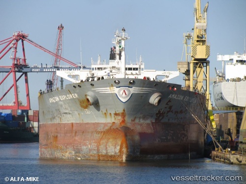
Vessel YONG TAI IMO: 9231511, MMSI: 355784000 Oil Products Tanker
UTC, 25.34947, 56.48430, course: 0, speed: 0.6
UTC, 25.34932, 56.48168, course: 57, speed: 0
2026-02-17 02:02:43 UTC, 25.35118, 56.48308, course: 76, speed: 0.5
Live AIS position:
UTC. Near KHORFAKKAN),
updated 2026-02-17 02:02:43 UTC.
Find the position of the vessel YONG TAI on the map. The latter are known coordinates and path.
marine traffic ship tracker show on live map
The current position of vessel YONG TAI is 25.35118 lat / 56.48308 lng. Updated: 2026-02-17 02:02:43 UTCCurrently sailing under the flag of Panama
YONG TAI built in 2002 year
Deadweight:
72910 tDetails:
Last coordinates of the vessel:
UTC, 25.31877, 56.94304, course: 272, speed: 12.6UTC, 25.34947, 56.48430, course: 0, speed: 0.6
UTC, 25.34932, 56.48168, course: 57, speed: 0
2026-02-17 02:02:43 UTC, 25.35118, 56.48308, course: 76, speed: 0.5